26
Imperfections Not Stated
Maps, Plans,
etc
310
Print: Dublin, [After Montburo]
-
Dublin
Castle,
a large black and white double page
Print depicting a Southern view of the
Castle, with people leisurely prancing on
the lower lawns, approx. 34cms x 50cms,
mounted and framed. (1)
€80 - 120
311
Co. Wicklow: Birch (J.) Arch.
Improved
Agricultural Labourer’s Cottages erected in
the Co. Wicklow, Ireland...
L. 1877. Printed
litho sheet with designs, approx. 21.5cms x
38.5cms (8½” x 15¼”) framed. (1) €140 - 200
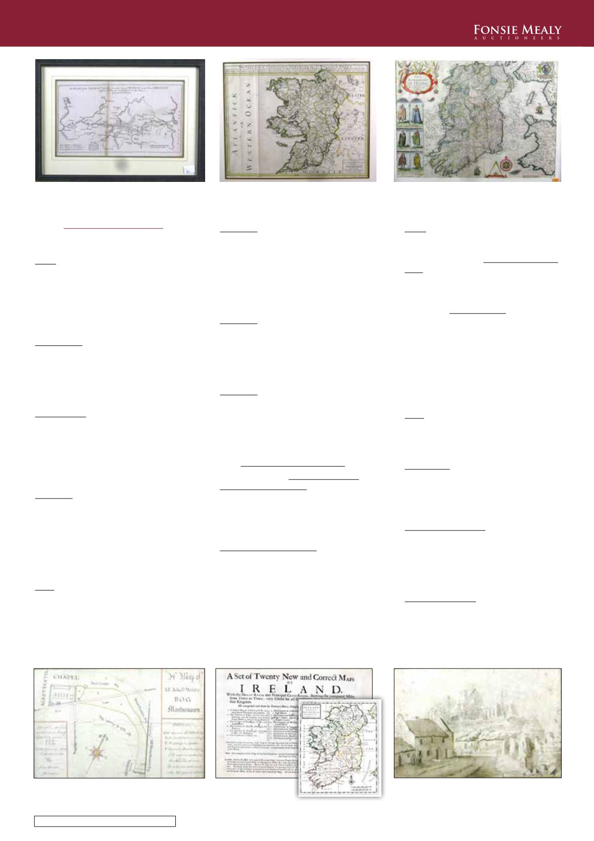
312
Grand Canal -
A Plan of the Grand Canal
from the City of Dublin to the River Shannon,
with the Collateral Canals to the Rivers
Barrow and Boyne. c. 1770. A printed plan
18cms x 29.5cms (7” x 11½”), framed. Scarce.
(1)
€180 - 240
313
Irish Map: [Mount & Page, Capt. John
Seller],
Untitled Sea Chart, displaying the
coastline from Monksland to Dalkey Island,
with detailed inset of the Channel & City of
Dublin, c. 1690, approx. 18” x 22 (46cms x
56cms), mounted and framed, as a map. (1)
€180 - 220
314
Map: Berry (William)
The Province of
Connaught
Surveyed by Sir William Petty,
L. c. 1720 Attractive hand cold. engd. map,
approx. 46cms x 57.5cms (18” x 22½”),
framed. (1)
€200 - 300
315
Irish Map: Speed (John)cart. & Hondius
(Jacobus) engd.
The Kingdome of Ireland
Devided into severall provinces, and againe
devided into counties newly described,
c.
1676, contemp. hd. colouring, text verso,
approx. 38cms x 50cms (14½” x 20”), framed.
(1)
€200 - 300
316
Irish Map: Speed (J.)
The Countie of Leinster
with the Citie Dublin,
c. 1610, contemp. hd.
cold., text verso, approx. 42cms x 52cms
(16½” x 20½”), in hogarth type frame, some
wear, as a map, w.a.f. (1)
€180 - 220
317
Irish Map: Speed (John) & Hordius (J.)
eng.
The Province of Connaught with the Citie
of Galwaye Described,
c. 1632, contemp. hd.
colouring, approx. 40cms x 54cms (16” x
21”), framed. (1)
€180 - 250
318
Fine Manuscript Estate Map
Reardom (Martin)
A Map of Mr. John R.
Walsh’s Bog, Martinstown,
surveyed in 1850.
An attractive coloured map with drawing of
a Chapel, approx. 23cms x 37cms (9” x 14½”)
framed. (1)
€160 - 220
319
Early Dublin Plans & Map:
Westmorland
Lock Hospital Townsend Street,
Ground Floor,
First Floor & Second Floor Plans, a set of
3 large linen backed original manuscript
plans, c. 1840, and an earlier linen backed
manuscript
Estate Map, Dublin City from
College Green to King Street,
highlighted in
colour, c. 1750, some dam. at top, lacking
part of legend. As maps .w.a.f. Rare. (4)
€250 - 350
320
Atlas: Petty (Sir W.)
Hibernia Delineatio,
Atlas of Ireland. Lg. oblong folio 1968. Fac-
simile edn. published by Frank Grahan,
Newcastle upon Tyne. Lim. Edn. 500 Copies
Only. full page & fold. maps, orig. crimson
cloth. (1)
€200 - 300
321
Rare Irish Atlas
Moll (H.,)
A Set of Twenty New and Correct
Maps of Ireland,
oblong folio L. 1728. Gen.
map of Ireland (fold), & 19 other engraved
full page sheets, all maps hand coloured in
outline and all are loose sheets, unbound
and in folder. All v. good. As an Atlas, w.a.f.
(1)
€550 - 750
322
Map: Lotter (T.C.)
Belgica Foederata,
engd.
reprint hand cold. map, after 1761 original,
in figured walnut frame. (1)
€80 - 120
323
Cuala Press: A hand coloured Print,
entitled
Cashel,
Cashel of Royal Fame - You
Nobly Stand. Large print with view of The
Rock, in gilt frame. (1)
€125 - 175
324
Watercolour & Pencil:
The Rock of Cashel,
a sepia watercolour with cottages and
figures, Rock beyond, early 19th Century,
framed; and a pencil sketch
Crubeen Bridge,
Carrigrohand [Cork],
framed. (2) €130 - 180
325
Co. Offaly Printing:
Borrisokane Union -
Notice of Rates....,
signed by James A. Ralph,
Clerk of Union, dated 28th September 1891.
A large broadside Poster, printed at Midland
Tribune, ... Birr. Framed. (1)
€120 - 170
312
314
315
318
321 & detail
324


